Context
GeoMaps is part of GEODE 4D program which aims to provide multiscale cartographic vector maps to French MoD. It is also part of MGCP international program.
The production cover about 2 million square kilometers, mainly in Africa and Middle East, on very diversified geographic domains. Since 2005, Geo212 has produced a hundred studies to prepare cartographic production for French MoD.
Project description
Geo212 offers original studies on various geographic thematics: seasonal and hydrographic evolutions, topography, urbanization, economy, transportation infrastructures, security features, etc. The impact of these thematics on satellite imagery and cartographic production are important. Zoning to estimate production costs and needs are provided.
High value data (urban objects of interest and roads data) are provided to support cartographic production.
Figure - Analysis of an African big city
Open source maps and others existing maps are analysed to get an overview of available and relevant cartographic data on an area of interest.
These data sources are used to produce, by cross-reference analysis, high value data of road network and points of interest.
Another important aspect of the project is the technologic watch. New products (cartographic and satellite imagery products) over our areas of interest are monitored and reported to our customers.
To foresee evolutions on our areas of interest a news watch is conducted. New projects and points of interest are monitored and capitalized in a custom database. A macro analysis of the territories enables to determine which evolutions are the most dynamic (for example: urban growth).
17 countries in Africa and Middle East are currently monitored through an obsolescence evaluation process. This decision support tool enables our customers to know in real time the condition of their cartographic assets.
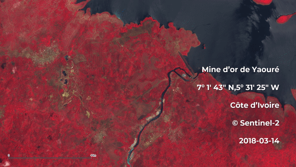
Figure
Monitoring of a gold mine project