Context
This project is part of the international partnership dedicated to the creation and sharing of IPHG human geography data in which the French MinArm is committed,International Program for Human Geography.
Project Description 2022
The study was divided into three phases.
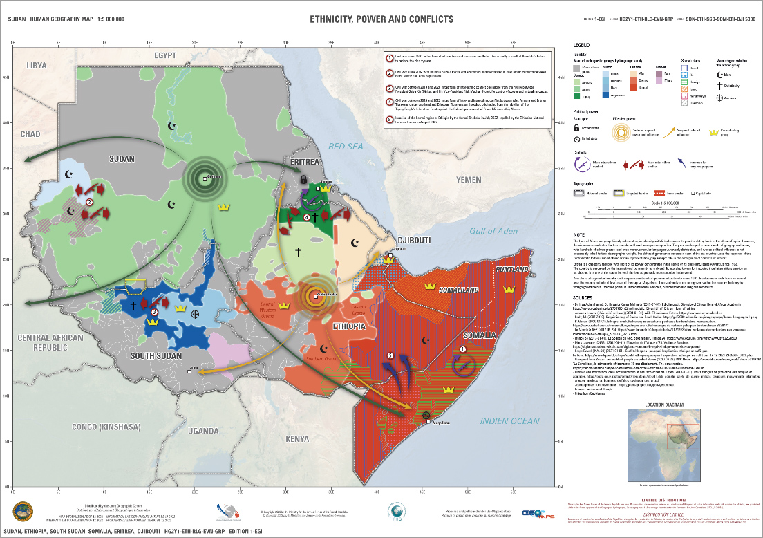
GEO212: Analysis of the ethnic, linguistic, religious, demographic and economic aspects of a geographic region.
1. Search for Sources
- Inventory
- Crossing and verification of information
- Qualification to IPHG standards
2. Filling the GDB
- Digitizing a vector background
- Filling in selected information in the GDB
3. Cartographic production
- Thematic map conception
- Layout for paper and digital format (GeoTiFF, GeoPDF, etc.)
The project was based on large bibliographic research (studies and academic works, publications and statistics from public institutions (national and international), specialized or general press, etc.), on information previously capitalized by Geo212 on the area and on cartographic and statistical data available in open sources.
The first phase of the project consisted in understanding the geographical functioning of the area and in drawing up an inventory of available sources on the requested themes of human geography for the project. Each source is compared and qualified, ensuring it’s reliable, verified and consistent to feed to the database.
The second phase of the project aimed to feed the Geodatabase with the previously selected information. It included a digitization step to constitute a foundation layer used as a cartographic background to gather the various information collected (ethnolinguistic distribution areas, infrastructures and structuring economic objects). The second step is the collection of the semantic information (for instance ethnic name, relief system, domination of a group over another, etc.). The information was collected in accordance with the normative requirements of the IPHG specifications.
Finally, the last phase of the project consisted in producing thematic maps. The maps have been designed and produced to provide a multidimensional understanding of the area (regional or at the level of each country of the zone). The design of the maps has been developed for multiple media, paper (A3 & A1) and digital (GeoTiFF & GeoPDF).
Contact
For any demonstration or additional information, please, contact
Nicolas Saporiti: nicolas.saporiti@geo212.fr